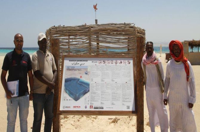
HEPCA installs signboards in Marsa Alam & Wadi El Gimal for public awareness as part of the USAID LIFE - Red Sea Sustainabale Growth II Project
Continuing our efforts to promote public awareness, HEPCA installed 15 instructional signboards in the most heavily used coastal dive sites in the area of Marsa Alam and Wadi El Gimal National Park.
The signboards contains a General Map of the Red Sea and Site Geographical Coordinates and dive site map – Including Symbol key (Legend), Compass, Depths, Bottom composition, Definitions of Coral Formation (Reef slope, Reef table, pinnacle…etc.) and code of conduct and best practices
Environmental Instruction and Regulations included in 8 different languages (Arabic, English, German, Italian, Czech, Polish, Russian and French) and list of the Emergency Contacts
Selected sites in Marsa Alam Area (Marsa abu Dabbab - Marsa Al Naba’a - Marsa Shagra - Marsa Abu Areiki - Marsa Jabal El Rosas - Marsa Ijlah - Marsa Asalay - Marsa Samadai - Marsa Umm Tondaba - Marsa El Nakari)
Wadi El Gimal National Park Area ( Marsa Wadi El Gimal - Marsa Hankorab - M.S Hamada Wreck in Abu Ghosoun - Marsa Lahami - Marsa Wadi Lahami)
This is a part of USAID/Egypt LIFE – Red Sea Sustainable Growth II Project is a U.S. Government-funded project implemented in coordination with HEPCA. The project seeks to raise the standard of living within the southern Red Sea, all the while promoting environmental conservation and awareness


